The adage “the whole is greater than the sum of the parts” applies to pipeline integrity. At first glance, it might seem like two datastreams are twice as valuable as one. However, aligning two distinct datasets lets you infer a third “comparison” dataset. And the results multiply as more and more information is added, creating a snowball effect.
What does this have to do with Cognitive Integrity Management™ (CIM)?
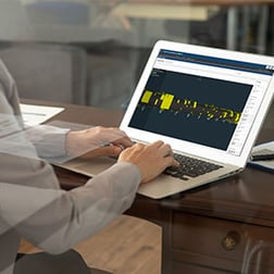
CIM takes in, compiles, and aligns data from almost any source. You glean insights, learn more about your pipeline, and make better integrity decisions by uniting data.
This post provides a detailed look at the sources you can integrate and align with CIM.
GIS-PODS Data
Cognitive Integrity Management™ works with independent systems, including GIS (Geographic Information Systems) and PODS (Pipeline Open Data Standard). CIM’s algorithms align ILI-to-GIS (PODS) via various APIs (application programming interfaces).
This syncing includes “mutually visible assets (valves, casings, AGMs, etc.) that provide spatial (latitude, longitude, elevation)-to-engineering stationing (begin/end, m-value) alignment.” (PRCI 2021)
Engineers can also manually enter data (such as pipe properties, HCA information, tool tolerances, etc.) instead of pulling it from GIS.
Inline Inspection (ILI) Data
CIM can ingest, standardize, and align datasets from any smart tool, or ILI, run. This makes it possible to merge years of valuable pipeline information regardless of vendor or format.
Drag a dataset into CIM’s onboarding tool, and the algorithms use pattern recognition to identify and spatially align mutually visible features in each dataset. Specifically, factors “such as block valve locations, girth welds, individual geometric patterns of corrosion and…flow reversal, where the values reported in one dataset are inverse with respect to another.” (PRCI 2021)
Using the cloud’s computing power, CIM transforms entire datasets at scale; instead of only scrutinizing 5-10% of a smart tool run, engineers can now include complete tool runs in their analysis.
See our whitepaper How Automated Data Normalization & Alignment Helps Operators Make Better Decisions.
Additional Integrity Data
With CIM’s software assistance, analysts can easily combine several data sources, potentially revealing valuable insights.
Our platform deepens your knowledge of an asset by aligning integrity-related data, such as:
CIS/CP – CIS vs ILI depths: CIM uses spatial latitude and longitude to align CP to existing ILI and/or GIS (PODS) data. Our program “correlates each anomaly (corrosion, dent, crack) that has already had pit-to-pit alignment across all ILI assessments done to the closest CP survey results point.” (PRCI 2021)
Internal corrosion: Field data from coupons, water analysis, and chemical usage can be aligned to ILI results. This aids with determining if your chemical spend is effective and your monitoring data is reliable.
Repair data: Aligning repair data to ILI results helps evaluate tool performance and track repairs. CIM’s records will indicate “already addressed” digs on future tool runs.
Tool tolerance specifications: Upload tool spec data into CIM for each ILI run to see how the tool performed based on historical and current field measurements.
Operating pressure & flowrate data: Upload operating pressure and flowrate data to calculate the remaining life of crack-like features found on your ILI. You can also assess water entrainment velocity and downtime compared to ILI results.
Soon, pipeline companies may transport hydrogen-gas mixtures as part of a global energy shift. This transition will challenge the industry and spawn more data growth. However, CIM is ready; its learning algorithms can handle even the newest datasets.
For specifics, see our webinar on ingesting and integrating datasets into CIM.
Data as a Service (DaaS)
DaaS (data as a service) enables two or more organizations to exchange machine-readable data sources smoothly. For example, OneBridge’s CIM pulls and aligns data from the following resources:
- SSURGO (Soil Survey Geographic database)
- National Transportation Dataset
- National Wetlands Inventory
- National Hydrography Dataset
- USGS Seismic Activity Dataset
CIM relates these data sources to your pipeline segments in several ways.
For SSURGO, we match the intersection of ILI anomalies to SSURGO’s mapping polygons and pull the most probable soil properties.
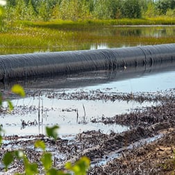
For Transportation and Hydrography, we use either the intersection or the spheroid distance from anomalies to those geohazard features. With water bodies, we pull NHDPoint, NHDWaterbody, NHDFlowline, NHDArea, and Wetlands data.
OneBridge: We’re tying it all together
How integrity teams integrate, manage, and analyze pipeline data will ultimately determine the value they derive from it. By unifying ILI, CP, GIS, digs, and more into a single source, you’ll be primed to make superior data-driven decisions.
At OneBridge, we’re unleashing more of the pipeline industry’s data potential. Our adaptable ingestion algorithms future-proof the CIM platform, as it can adapt to data from any new source.
For a sneak peek of the platform, watch this on-demand replay of our webinar: Pipeline Industry, meet CIM
See all the Data Sources You Can Integrate with CIM HERE.